The ENSO or El Niño Southern Oscillation refers to one of the most important climate phenomena on earth. This phenomenon influences weather worldwide. ENSO consists of 3 states: El Niño, La Niña, and Neutral. For these states to occur, there must be changes in both the ocean and the atmosphere.
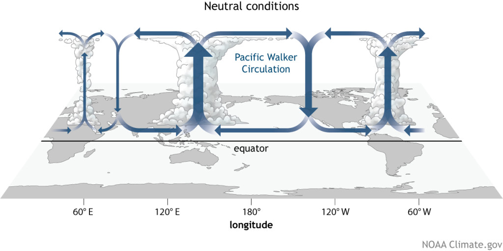
Neutral Conditions
Typically, water near the equator off the coast of South America is warmed by the sun. This warmed water is then pushed west by trade winds. The result is warm water piling up near Indonesia and Australia. As this warm water is pushed west, warm, moist air rises in Indonesia and Australia. When that warm, moist air rises, it releases its moisture through rain. As the air rises it now begins to cool, and as it cools, it moves east and west and ultimately falls as cool, dry air. This pattern of warm, moist air rising and cool, dry air falling affects weather systems worldwide.
Credit: NOAA Climate.gov
Credit: NOAA Climate.gov
In addition to the atmospheric effects, when the warm water is pushed west from the coast of South America, it allows cool water from below to rise to the surface, bringing nutrients. These nutrients allow the ecosystem off the coast of South America to flourish. Without this upwelling, much of the marine life does not have what it needs to survive.
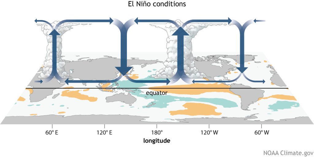
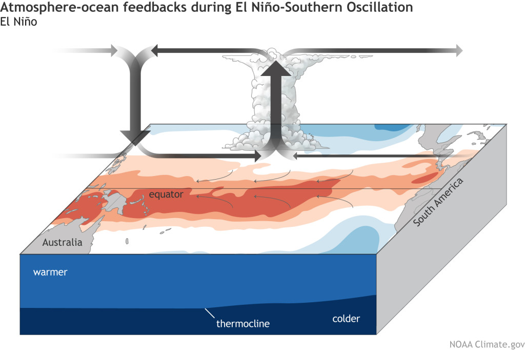
El Niño
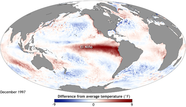
During an El Niño, the trade winds weaken. Because of the weakened trade winds, the warm water does not get pushed west and instead builds up near the western coast of South America and the central Pacific Ocean. This results in sea surface temperatures that are greater than during the neutral state.
Credit: Maps by NOAA Climate.gov, based on data provided by NOAA View.
Credit: Maps by NOAA Climate.gov, based on data provided by NOAA View.
The higher sea surface temperatures result in the warm, moist air that typically causes rain in Indonesia and Australia rising instead off the coast of South America and in the central Pacific Ocean. This can lead to droughts in Indonesia and Australia and flooding in areas like Peru.
Because the warm water stays near the coast of South America, the upwelling of cold water and nutrients that would normally occur does not. The lack of nutrients and the warmer-than-normal water leads reliant organisms to die or migrate elsewhere. In this way, an El Niño can disrupt the entire ecosystem.
Credit: NOAA Climate.gov
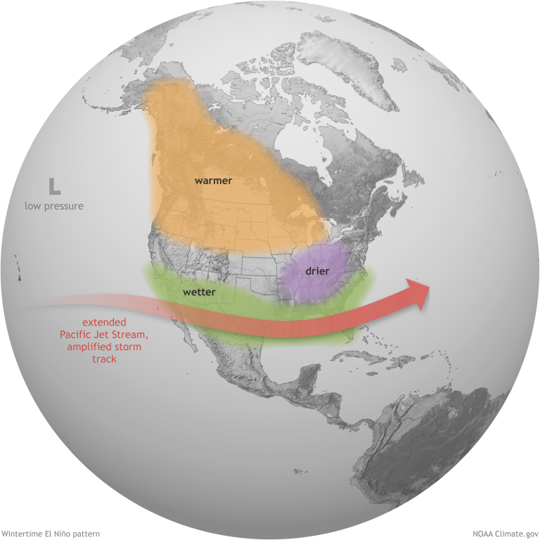
How does El Niño impact weather in the United States?
The warmer waters off the coast of South America cause the Pacific Jet Stream to move south. This causes the Southwest, Gulf Coast, and Southeast United States to be wetter than normal, which can lead to flooding. An El Niño also causes the North Central and Northwest United States to be warmer than normal. Other areas become drier than normal. An El Niño can cause a less intense hurricane season. All of this can impact agriculture, wildfires, and ecosystems as a whole.
Credit: NOAA Climate.gov
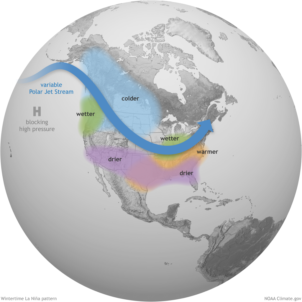
La Niña
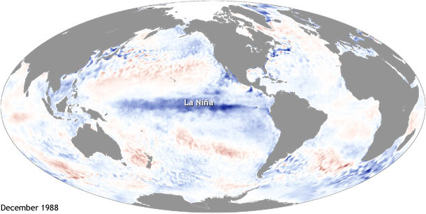
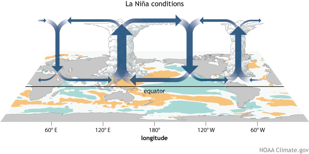
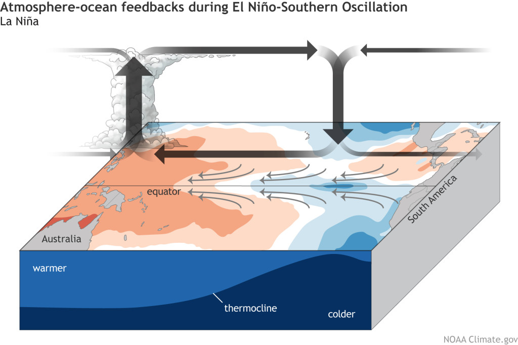
During a La Niña, the trade winds strengthen. Because of the strengthened trade winds, more warm water is pushed towards Indonesia. This causes lower-than-normal sea surface temperatures off the coast of South America and the central Pacific Ocean.
Credit: Maps by NOAA Climate.gov, based on data provided by NOAA View.
Credit: NOAA Climate.gov
The result is more warm, moist air rising near Indonesia and Australia, which can lead to flooding in those areas.
Because the warm water is moved even further, the upwelling of cold water intensifies, and more can rise to the surface than before. This brings more nutrient-rich material to the surface.
Credit: NOAA Climate.gov
How does La Niña impact weather in the United States?
A La Niña typically results in the Jet Stream being pushed northward. This can lead to drought in the Southern United States and wetter weather with possible flooding in the Pacific Northwest, Great Lakes area, and Ohio Valley. La Niña can also result in a more severe hurricane season. All of this, as is the case with El Niño, can impact agriculture, wildfires, and ecosystems as a whole.
Credit: NOAA Climate.gov
Monitoring La Niña and El Niño
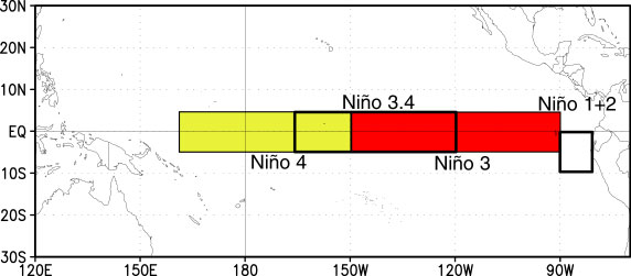
To determine whether an El Niño or La Niña event is occurring, researchers monitor sea surface temperatures in the Equatorial Pacific. The specific areas of the Pacific Ocean that are monitored for these events are called Niños and refer to the areas where changes are typically seen during an El Niño or La Niña event. Typically, the Niño 3.4 area of the central Pacific Ocean is the area used to define an El Niño or La Niña event since it tends to represent the average of events in the Equatorial Pacific.
Credit: NOAA/ National Weather Service
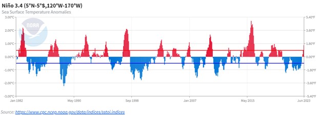
Researchers also use what is called an Oceanic Niño Index, which is based on the same area as the Niño 3.4 in the central Pacific Ocean. This index uses a running mean of the last 3 months. For an event to be classified as an El Niño, the mean sea surface temperature must be +0.5° C; for a La Niña event, it must be -0.5° C for 5 consecutive months.
Credit: NOAA/ National Weather Service
Credit: NOAA
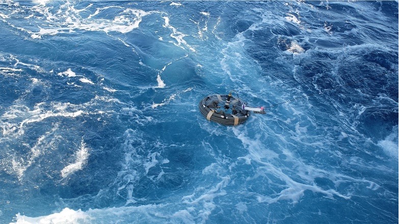
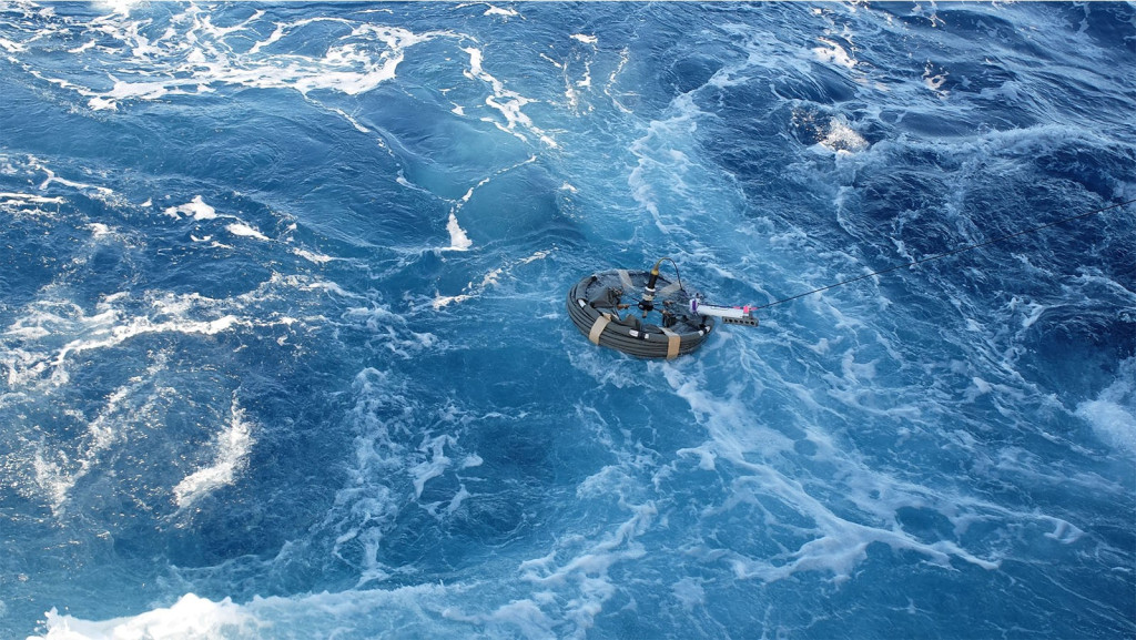
To measure sea surface temperatures, researchers use a variety of methods, taking direct measurements of the ocean through buoys, ships, and ocean reference stations. There are thousands of floats in the ocean as part of the Global Drifter Program (GDP) that continuously gather data about the temperature and salinity of the oceans.
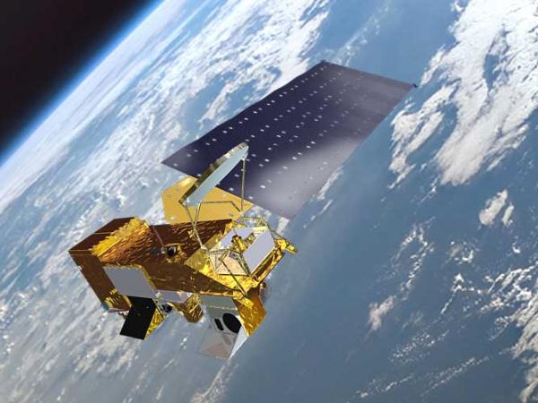
Satellites are also used. For example, NASA’s Terra and Aqua satellites include Moderate Resolution Imaging Spectroradiometer (MODIS) on board and orbit the earth approximately 14 times a day gathering data. In addition to other data, they provide information on sea surface temperatures, bringing in more data in 3 months than all the data previously gathered before the use of satellites.
Caption: NASA’s Satellite Aqua Credit: NASA
With a phenomenon with as many global impacts as an El Niño or La Niña, researchers all over the world are monitoring the data. For current information, go to NOAA Climate.gov. You can monitor sea surface temperature anomalies at the Climate Prediction Center. For more El Niño and La Niña measurements, visit the El Niño Theme Page.